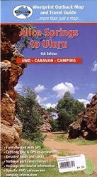
HEMA Alice Springs to Uluru Map
HEMA Alice Springs to Uluru Map
WestPrint Heritage Maps are designed to provide the traveller with a guide to understanding the history and environment through which you travel on outback tracks. Some of the most unusual landforms in the world can be found in Central Australia. Much of this area has only been accessible to visitors for about 30 years and some roads and facilities are well suited to the modern adventurer. All Westprint maps contain notes on history, explorers, points of interest, surrounding flora and fauna and contain various photos of landmarks. The maps are very clear to read and have road distances, rest areas, caravan parks and fuel outlets noted. The map is clear with symbols referring to textual information provided on the back of the map explaining each point of interest, surrounding flora and fauna.
This map covers: Alice Springs, Uluru (Ayre's Rock), Macdonnell Ranges, Kings Canyon, Docker River, Giles and surrounds.
Dimensions
Dimensions
Share